Strategy 1 Complete the All Ages and Abilities Network.
The actions within this strategy are divided into two categories:
Action we will DOActions we will SUPPORTAction we will do are followed by “DO” and are colored in dark gray, and actions we will support are followed by “SUPPORT” and are colored in light gray.
Learn more about how we get thereThe All Ages and Abilities Network will include three primary bikeway types:
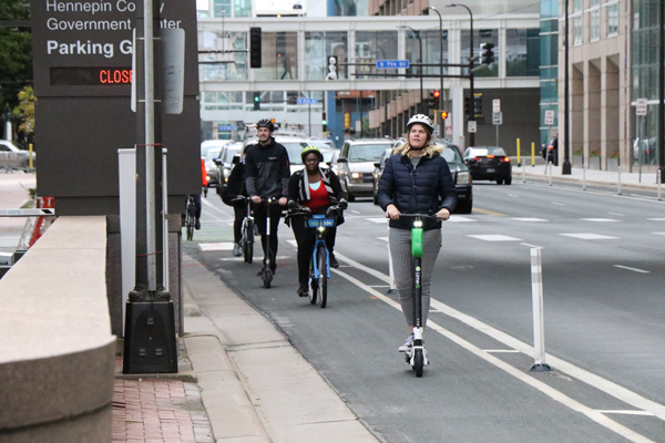
- Protected bike lanes: routes on relatively busy streets with some form of physical separation from motor vehicle traffic, such as bollards, concrete curbs, parked cars, and planters.
- Trails: non-motorized paths for pedestrians and bicyclists, typically more separated from the street than protected bike lanes, and are typically located near rivers, lakes, parkways, and railroad corridors.
- Neighborhood greenways: routes that enhance local, low volume streets and give priority to people walking, biking, and rolling. This will include removing or significantly limiting motor vehicles along sections of the street.
There is an additional type of bikeway highlighted on the All Ages and Abilities Network called connector bikeways which are standard bike lanes without physical separation from motor vehicles, that may or may not meet the definition of an All Ages and Abilities bikeway depending on the context of the street (including volume, width and speeds).
The All Ages and Abilities Network was developed by studying numerous factors that influence where people bike, including transit, high density areas, commercial activity, land use, connections to schools and High Injury Streets for people biking.
Actions to complete the All Ages and Abilities Network.
Bicycling 1.1
Build all low-stress routes identified on the All Ages and Abilities Network by 2030, which will include a total of 140 miles of new or upgraded bikeways, including: ● 80 miles of protected bike lanes that provide a low-stress riding experience on high volume corridors. ● 51 miles of new neighborhood greenways that manage motor vehicle volume and speed, improve safety at major crossings and reduce stopping at minor crossings. Start with the Northside Greenway and the Southside Greenway. ● 9 miles of new trails that provide connections along the Mississippi River or along rail lines that could be converted to trails.
Supported goals:
Safety Mobility
Related actions:
Difficulty:
High
Timeframe:
2020-2023 (Years 0-3)
Status:
Successfully completed to date and on-going
Significant milestone(s):
By the end of 2024, the City had built or upgraded 30.8 miles of low-stress bikeways and 3.3 miles of connector bikeways on the All Ages and Abilities Network. The City continues to design and install low-stress bikeways where feasible.
Bicycling 1.2
Improve existing bollard protected bike lanes with more permanent separation, such as curb barriers and planters or other green infrastructure.
Supported goals:
Safety Mobility
Related actions:
Difficulty:
Medium
Timeframe:
2020-2023 (Years 0-3)
Status:
Successfully completed to date and on-going
Significant milestone(s):
Public Works continues to look for opportunities to improve existing bollard protected bike lanes with more permanent separation. Some examples include Whittier Lyndale and Hennepin Dunwoody.
Bicycling 1.3
Consider building bikeways not included on the All Ages and Abilities Network to respond to development opportunities and changing transportation demands.
Supported goals:
Safety Mobility
Related actions:
Difficulty:
Low
Timeframe:
2020-2023 (Years 0-3)
Status:
Successfully completed to date and on-going
Significant milestone(s):
Public Works considers opportunities to build bikeways not on the All Ages and Abilities Network during project development. Some recent examples where bikeways have been considered include University Ave NE, 8th St SE, Lyndale Ave S and 21st Ave N.
Bicycling 1.4
Use design to build projects that prevent blocked lanes or conflicts with loading and parked vehicles.
Supported goals:
Safety Mobility
Related actions:
Difficulty:
Medium
Timeframe:
2020-2023 (Years 0-3)
Status:
Successfully completed to date and on-going
Significant milestone(s):
In 2021, Public Works developed the Minneapolis Street Design Guide (SDG). The SDG includes bikeway design guidance to physically separate bikeways from the roadway when possible to minimize blocked bike lanes and conflicts with loading and parked vehicles. Examples of this type of design include Hennepin Avenue in downtown Minneapolis.