Strategy 8 Coordinate with agency partners who own, operate, and manage infrastructure within the City to plan, build and operate at the City’s standards.
The actions within this strategy are divided into two categories:
Action we will DOActions we will SUPPORTAction we will do are followed by “DO” and are colored in dark gray, and actions we will support are followed by “SUPPORT” and are colored in light gray.
Learn more about how we get thereStreets in Minneapolis are owned and operated by one of five agencies: the City of Minneapolis, Hennepin County, the Minnesota Department of Transportation, the Minneapolis Park and Recreation Board and the University of Minnesota. Typically, the systems and volumes increase from local to county to state systems – and design decisions are often influenced by accommodating an increasingly higher volume of street users.
While final responsibility and determination for design decisions for a particular street is held by the underlying jurisdictional owner, the design process is often collaborative between the overlapping jurisdictions and we work with our partners to reach design and operational decisions that reflect our values and goals while recognizing their underlying authority.
Actions to coordinate with agency partners who own, operate, and manage infrastructure within the City to plan, build and operate at the City’s standards.
Street Operations 8.1
Manage vehicle traffic volumes and mobility on the regional system and local streets by allocating space efficiently for use throughout the day versus focusing on peak travel times.
Supported goals:
Mobility
Related actions:
Difficulty:
Medium
Timeframe:
2020-2023 (Years 0-3)
Status:
Successfully completed to date and on-going
Significant milestone(s):
Public Works uses a Complete Streets approach to determine street operations as opposed to solely focusing on vehicle operations during peak travel times. Recent examples of projects where this approach is taken include Hennepin Ave S, Hennepin Ave downtown, and South 4th St.
Street Operations 8.2
Ensure that streets serving freeway connections reflect the Complete Streets Policy; maintain local street qualities as opposed to facilitating freeway movements at streets leading to or from freeway access ramps, where streets change character (from highway to arterial) or when streets change owner (from State or County to City).
Supported goals:
Safety Mobility
Related actions:
Difficulty:
High
Timeframe:
2020-2023 (Years 0-3)
Status:
Successfully completed to date and on-going
Significant milestone(s):
Public Works coordinates with agency partners to build and maintain Complete Streets. The Hennepin-Dunwoody protected bikeway, Hiawatha Ave ADA and intersection upgrades, and Portland Ave protected bikeway at Highway 62 are some examples of relevant projects.
Street Operations 8.3
When partner agencies have authority over street design and use of the right of way, pursue changes that better align with the Street Design Guide, the Complete Streets Policy and Vision Zero.
Supported goals:
Safety Mobility Active Partnerships
Related actions:
Difficulty:
Medium
Timeframe:
2020-2023 (Years 0-3)
Status:
Successfully completed to date and on-going
Significant milestone(s):
The City uses its Complete Streets Checklist process to pursue changes that better align with City policies when partner agencies have authority over design and right of way use.
Street Operations 8.4
Study the viability of the following changes to the regional network:
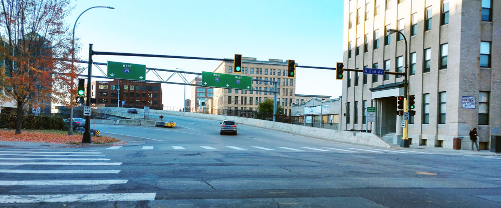
- Convert the I-94 freeway bridge connections via 3rd/4th Streets (North Loop viaduct) to MnPASS only, with the long-term goal of eliminating this and similar facilities.
- Close or reconfigure Interstate 394 access at Washington Avenue N and 3rd Avenue N.
Supported goals:
Safety Equity Prosperity Mobility
Related actions:
Difficulty:
High
Timeframe:
2028-2030 (Years 8-10)
Status:
In Progress
Notes:
City staff coordinated with MnDOT to improve the pedestrian experience at the Interstate 394 access at Washington Ave/3rd Ave N. The City is advocating that the Blue Line Extension is designed to preserve options for the eventual removal of interstate viaducts.
Street Operations 8.5
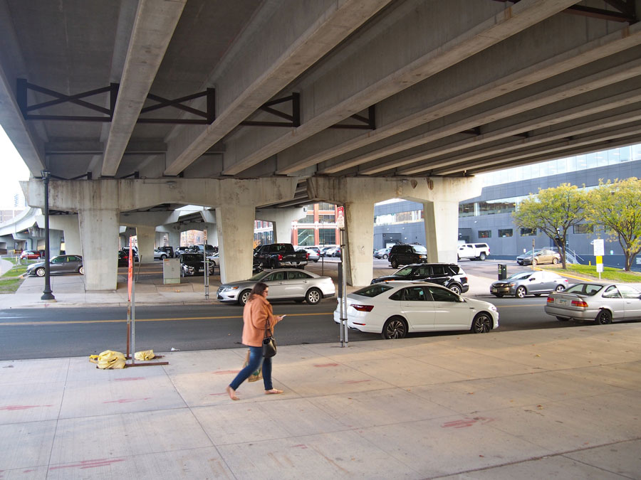
Support efforts to convert street right of way to land for other uses, using public/private partnerships as appropriate. Ideas include:
- Develop lids or land bridges to reconnect communities. See Walking Action 6.5.
- Identify alternatives for using the land on freeway embankments such as energy collection with solar panels or wind harvesting; water management and purposeful plantings; and as dedicated public transit corridors.
Supported goals:
Equity Prosperity Mobility Active Partnerships
Related actions:
Walking 6.5
Difficulty:
High
Timeframe:
2028-2030 (Years 8-10)
Status:
In Progress
Notes:
Alternative land uses of public right of way are under consideration as part of the Rethinking I-94 project.
See also actions:
- Transit 2.7
Transit advantages on freeways through lane conversions - Design 6.1
Changes to regional functional class system